Toronto could see up to 30 cm of snow this weekend, prepare now
Environment Canada warns 20–30 cm of snow may arrive Sunday, with lake-effect enhancement and wind chills near −30 C. Rearrange travel and prepare homes and vehicles.
Copy link
By Torontoer Staff
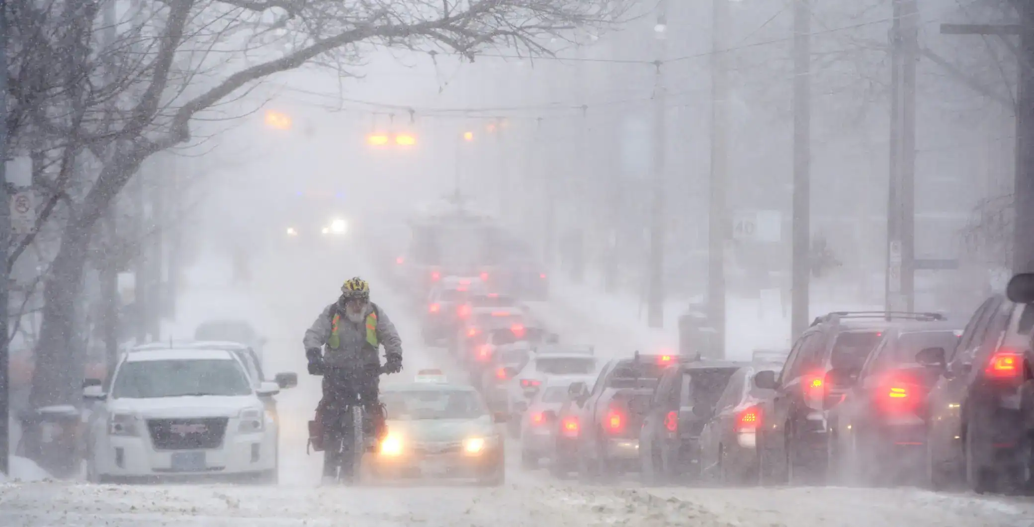
A major winter storm moving north from the United States is forecast to hit the Greater Toronto Area beginning Sunday, with Environment Canada calling for 20 to 30 cm of snow, and the potential for higher totals where lake-effect snow from Lake Ontario intensifies accumulation. The agency is urging people to avoid or rearrange travel, particularly Sunday evening, as blowing snow and icy roads are expected.
The system is expected to start Sunday morning and last into early Monday, arriving as the city braces for one of the coldest mornings of the season, with wind chills predicted near −30 C.
What to expect
Environment Canada says Toronto is likely to receive the northern edge of a U.S. winter storm, and enhanced lake effects from Lake Ontario could push snowfall higher than the base forecast of 20 to 30 cm. Snow will be accompanied by gusty winds, which will reduce visibility and create blowing snow, especially Sunday afternoon and evening.
If people can help it, rearrange travel plans to Saturday, if possible. If not, get the travelling done sooner than later in the day on Sunday, before the snow starts accumulating.
Trudy Kidd, Environment Canada meteorologist
How to prepare
Plan now so the storm disrupts your weekend as little as possible. Focus on travel, home readiness and basic winter supplies. Small adjustments before the snow begins reduce risk and stress during the storm and the busy commute that follows.
- Rearrange non-essential travel to Saturday, or travel early on Sunday before accumulation begins.
- Top up groceries, medications and essential supplies in case travel becomes difficult into Monday.
- Charge phones and portable batteries, and keep a battery-powered flashlight handy in case of power issues.
- Clear gutters and secure outdoor items that could be blown around by strong winds.
- Check your home heating system, insulation and the locations of shut-off valves for pipes.
Driving and transit tips
Expect slower traffic and potential delays on roads and transit. Environment Canada advises drivers to allow extra time and increase following distance. Visibility may drop quickly in heavy snow and wind, so adjust speed to conditions.
Be prepared by giving yourself lots of extra time to travel to your destination, lots of space between yourself and the vehicle in front, and then check those wipers, make sure they are in good working condition and have lots of wiper fluid.
Trudy Kidd, Environment Canada meteorologist
- Check transit service advisories before leaving. Allow extra time for buses, streetcars and GO service.
- If driving, fit winter tires, clear all windows and lights, and carry an emergency kit with blanket, shovel and de-icer.
- Keep your fuel tank at least half full to avoid fuel issues and to maintain heat if stranded.
- If possible, discuss remote work options with your employer for Sunday evening or Monday morning.
At home and caring for others
Extreme cold and heavy snow can affect vulnerable people and pets. Make a plan for older relatives or neighbours and ensure pets have adequate shelter and water that will not freeze. Protect exposed plumbing by insulating pipes and allowing a slow drip on taps if temperatures drop sharply.
- Check smoke and carbon monoxide detectors, since heating use will increase during the cold snap.
- Insulate pipes in unheated areas and consider keeping cabinet doors open under sinks to circulate warm air.
- Create a short shovel or snow-clearing plan for sidewalks and entrances to keep access clear for emergency services.
- Bring vulnerable plants indoors or cover them, and move vehicles from low-lying or exposed areas if flooding from snowmelt is a concern later.
Weekend forecast at a glance
Friday will see flurries in the afternoon and evening, followed by a sharp drop in temperature. Expect a daytime high around −15 C, falling to near −22 C overnight, with wind chills making it feel close to −31 C.
Saturday should be sunny but bitterly cold, with a daytime high near −12 C and morning wind chills close to −30 C. The low will be around −18 C.
Sunday is when the main snow arrives, with windy conditions and blowing snow. Forecast values put the high near −9 C and the low near −12 C, though actual conditions will depend on how much lake-effect snow develops.
Environment Canada expects the storm to taper off by Monday morning, but lingering snow and icy patches could affect the Monday commute.
Prepare now and adjust plans to avoid the worst travel windows. Check Environment Canada updates through the weekend for any changes to warnings or snowfall totals.
snowweatherwinterTorontoEnvironment Canada