Toronto deep freeze arrives Friday: a practical winter prep and safety guide
Arctic air will push Toronto to its coldest stretch, with wind chills near minus 30 C and heavy snow possible Sunday. How to protect people, pets, pipes and travel plans.
Copy link
By Torontoer Staff
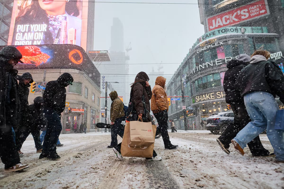
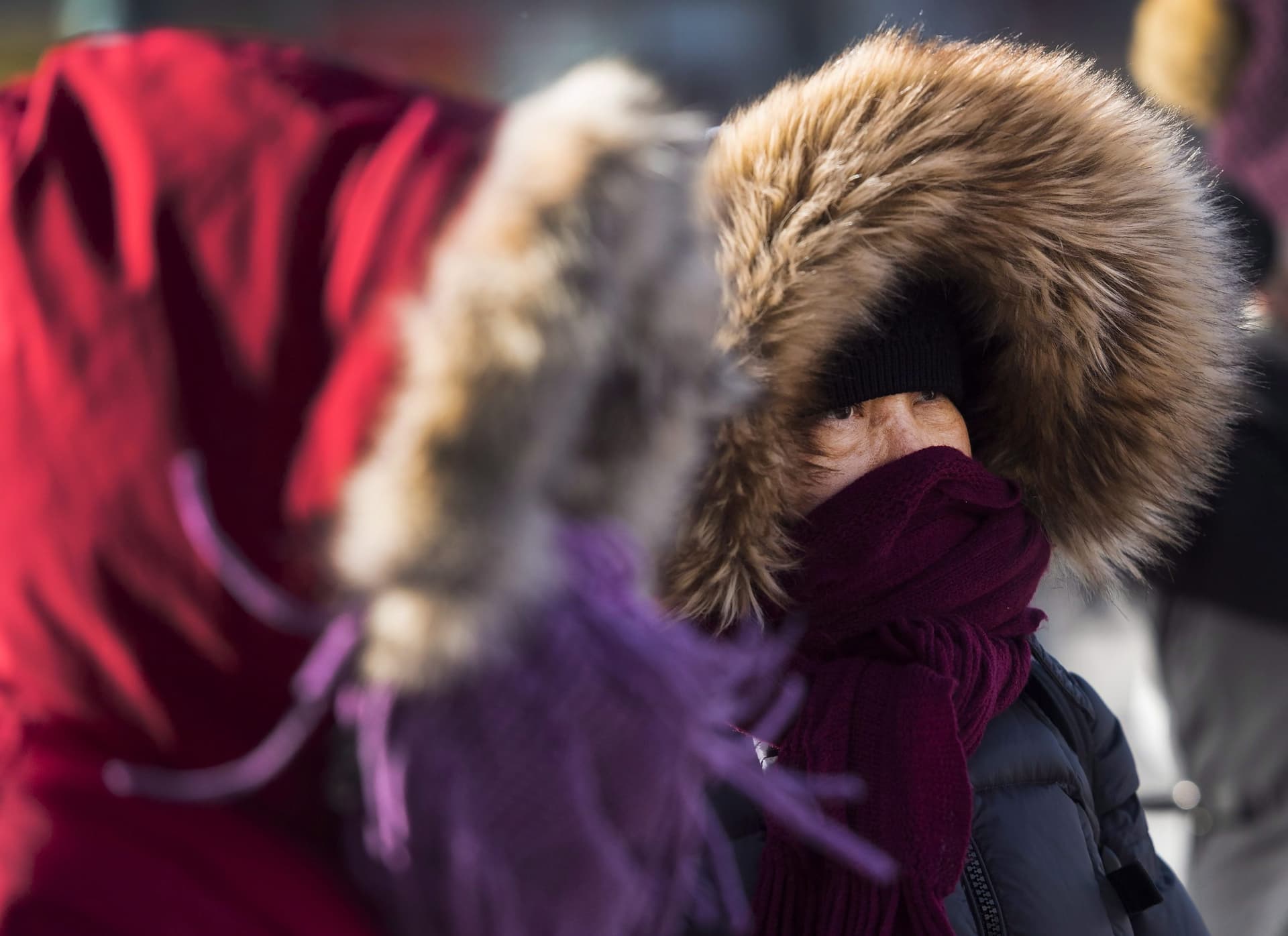
Toronto will enter a dangerously cold period beginning Friday night, as an Arctic air mass drives temperatures well below seasonal norms. Meteorologists expect wind chills to approach minus 30 C overnight into Saturday, conditions when frostbite can occur on exposed skin in minutes.
The extreme cold will be followed by a significant snow system on Sunday, with higher totals along the lakeshore. The city’s immediate priority is safety: limit outdoor time during the worst of the cold, protect vulnerable people and pets, and prepare homes and vehicles for both frigid temperatures and accumulating snow.
How cold, and when
Forecasters are calling for overnight lows in the minus 20 C range across the Greater Toronto Area, with wind chill values near minus 30 C late Friday into early Saturday. Public health and weather agencies typically issue Extreme Cold Warnings when wind chills fall to about minus 30 C, and similar alerts are expected to be in effect through Saturday morning.
Wind chills are expected to approach minus 30 C late Friday night and Saturday morning, creating a risk of frostbite in minutes on exposed skin.
Environment Canada
What to do now: immediate safety steps
- Stay indoors during the coldest hours, especially between late Friday night and Saturday morning.
- Check on older neighbours, people with mobility issues, and anyone without reliable heating.
- Keep a close eye on infants and young children, who lose heat faster than adults.
- Limit outdoor exercise, and avoid prolonged exposure for people who work outside.
- Use layered clothing if you must go out: base layer, insulating midlayer, and a windproof outer layer.
Pets, livestock and outdoor animals
Bring pets indoors if possible. If animals must remain outside, provide insulated shelter raised off the ground, dry bedding, and unfrozen water. Check pet paws after walks for signs of frostbite or ice accumulation. For community concerns about stray animals, contact local animal services before the cold intensifies.
Protecting your home and pipes
Freezing temperatures increase the risk of burst pipes and heating failures. Take these steps now to reduce damage and disruption.
- Insulate exposed pipes in basements, crawl spaces and attics. Leave a slow trickle of water running from taps connected to vulnerable pipes.
- Keep interior doors open to allow warm air to circulate, and set thermostats no lower than 18 C if you can.
- Know where your main water shutoff valve is located and how to turn it off in an emergency.
- Stock up on basic emergency supplies: bottled water, non-perishable food, flashlights, batteries and a battery-powered radio.
Travel, transit and commuting
Saturday may still be very cold even if the worst of the wind chills subsides. Sunday will bring the expectation of significant snowfall, especially near the lakeshore. Plan trips conservatively and allow extra time if you must travel.
- Avoid non-essential travel during the overnight cold snap and while blowing snow reduces visibility.
- If you drive, carry an emergency kit: blanket, warm clothing, water, snacks, shovel and a fully charged phone.
- Allow extra time for public transit connections. Check agency alerts for service changes during heavy snow.
- Keep fuel tanks at least half full to reduce the chance of fuel line freeze and to ensure you can keep the vehicle heater running if stranded.
Snowfall outlook for Sunday and Monday
A larger storm system moving across the eastern United States is expected to reach southern Ontario on Sunday. Before the main system arrives, a lake-effect snow band is likely to produce an initial 5 to 10 cm near the lakeshore on Sunday morning. The main event should begin after lunch, with downtown Toronto and nearby lakeshore areas at risk of totals in the 25 to 35 cm range. North of the city, amounts are expected to be lower, roughly 15 to 25 cm in the near-north GTA and 5 to 15 cm further north.
Because temperatures will remain very cold, the snow is expected to be light and fluffy, which makes it easy to blow around and can reduce visibility. Forecast totals may change as the storm track becomes clearer, so check updates before travel.
What to pack if you must go out
- Insulating hat and scarf to cover face and ears, gloves or mittens, and warm footwear with good traction.
- A warm, windproof coat and layers you can remove if you get warm indoors.
- Phone, portable charger and identification in a waterproof pouch.
- Hand warmers and a small emergency blanket if you expect to be outdoors for longer periods.
Monitor official sources for updates, including Environment Canada and municipal emergency channels. Sign up for local weather alerts and keep neighbours informed if you have concerns about heating or power outages.
This weekend’s cold and snow present overlapping hazards. Prioritise shelter, layer clothing, protect pipes and pets, and postpone non-essential travel until conditions improve.
weathercoldwinter-safetyTorontosnow