Winter storm to drop 20 to 30 cm across Toronto and the GTA this weekend
A winter storm will bring 20 to 30 centimetres of snow to Toronto and surrounding areas this weekend, with lake-enhanced bands creating localized totals and travel disruption.
Copy link
By Torontoer Staff
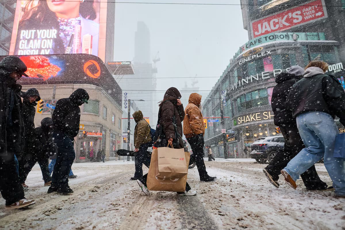
A winter storm is forecast to bring widespread snow to southern Ontario this weekend, with 20 to 30 centimetres likely across much of Toronto and the Greater Toronto Area. Lake-enhanced bands off Lake Ontario could push local totals higher, creating heavy, fluffy snow and difficult travel conditions.
The system is expected to arrive late Saturday and produce the heaviest snowfall on Sunday, with some snow persisting into Monday morning. Cold temperatures are projected to keep snow from melting through the rest of January and into early February.
Where the heaviest snow is expected
The Weather Network warned of "significant snowfall" for much of southern Ontario on Sunday as the northern edge of a U.S. system grazes the province and interacts with lake effects.
- 25 centimetres or more: Toronto, Pickering, Ajax, Oshawa, Bowmanville, Cobourg.
- 20 to 25 centimetres: Mississauga, Brampton, Vaughan, Markham, Richmond Hill, Milton, Oakville, Burlington, Hamilton, St. Catharines, Belleville, Kingston.
- 15 to 20 centimetres: Kitchener, Waterloo, Guelph, Fergus, Orangeville, Newmarket, Peterborough.
- 10 to 15 centimetres: Mount Forest, Barrie, Orillia and areas east toward Ottawa.
Lake-enhanced snow squalls are likely to develop off Lake Ontario overnight Saturday into Sunday morning. If winds align, those squalls could linger over parts of the GTA for several hours and produce whiteout conditions and rapid accumulation.
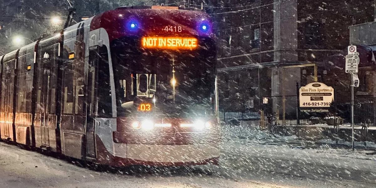
Travel and transit: what to expect
Expect highway delays and possible airport disruptions. The heavy, low-density snow will accumulate quickly and could make it hard for plows to keep up, especially where squalls set up.
- Check airline and GO Transit updates before heading to the airport or station.
- Allow extra travel time and be prepared for reduced speeds and lane closures on major routes.
- Consider delaying non-essential trips on Sunday and early Monday.
- If you must travel by car, ensure winter tyres are fitted and your vehicle has an emergency kit, full fuel, a charged phone and a scraper.
At-home prep checklist
- Stock up on essentials: food, prescription medications and any necessary supplies to avoid trips during the storm.
- Charge phones and power banks. Keep flashlights and fresh batteries handy.
- Clear eavestroughs if they are clogged, and move outdoor furniture or bins that could be buried by snow.
- Shovel pathways early and often to prevent heavy, compacted drifts. Use sand or ice melt on steps and slab entrances.
- Ensure heating systems are working and that you have a backup plan for power outages if you rely on electric heating.
How to dress and stay healthy
Temperatures will remain below freezing, so expect light, fluffy flakes and bitter wind chill where squalls occur. Dress in layers, choose waterproof outerwear and insulated, slip-resistant boots.
- Wear a warm hat, insulated mitts and a scarf or balaclava to protect exposed skin from wind and cold.
- Avoid heavy exertion while shovelling. Take frequent breaks and lift with your legs to reduce strain.
- Keep an eye on elderly neighbours and anyone with mobility challenges who may need help clearing paths or accessing supplies.
Driving tips for storm conditions
Snow squalls can create sudden whiteouts and slippery roads. If you must drive, slow down and increase following distance. Use headlights, avoid cruise control and be prepared for reduced visibility.
- Carry a winter emergency kit: blanket, warm clothing, shovel, ice scraper, snack food and extra water.
- Leave early to give yourself time to adjust to conditions, and let someone know your route and expected arrival.
- If conditions deteriorate, find a safe place to wait out the squall rather than pushing through poor visibility.
Places underneath these bands of snow could get 25 to more than 30 centimetres by Monday.
The Weather Network
Forecasters expect colder-than-normal temperatures to persist into early February, so the snow is likely to stick. Keep monitoring local weather updates and transport notices through Saturday and Sunday to stay informed.
Prepare for slower commutes and possible service interruptions, and focus on simple steps that reduce risk: check your travel plans, kit your car for winter, and make sure your home and family have basic supplies.
weatherwinterTorontoGTAwinter-prep