Blizzard and snow squall warnings in effect across southern and central Ontario
Blizzard and snow squall warnings cover much of southern and central Ontario, with strong winds, low visibility and 10–50 cm of snow possible in some areas.
Copy link
By Torontoer Staff
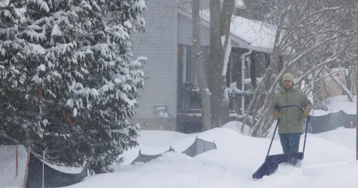
Blizzard and snow squall warnings are in effect across large parts of southern and central Ontario Monday, with Environment Canada forecasting strong winds, near-zero visibility and significant snowfall for several regions. Officials say conditions will make travel hazardous and that some areas could see up to half a metre of snow.
An orange-level blizzard warning covers 10 regions, including the Bruce Peninsula, Goderich, Hanover, Niagara Falls and northern and southern Perth counties. Snow squall warnings and blowing snow advisories are in place for additional communities from Windsor to Manitoulin Island.
Where the worst conditions are expected
Most regions should expect 10 to 25 centimetres of snow through the event, with higher totals in specific areas. The Bruce Peninsula and the Owen Sound region are forecast to receive between 20 and 40 cm. Local totals will vary where snow squalls set up and where winds produce drifting.
- Orange-level blizzard warnings: Bruce Peninsula, Goderich, Hanover, Niagara Falls, Northern Perth, Southern Perth, and nearby areas.
- Yellow-level snow squall warnings: Windsor-Essex, Chatham-Kent, Norfolk County, Kitchener, Kingston, Barrie, Parry Sound and Manitoulin Island.
- Higher-end totals: Parry Sound and Orillia are forecast to see closer to 20 cm, with some models showing upwards of 40 to 50 cm in localized spots.
Timing and expected conditions
Snow squalls are expected to begin Monday morning in many areas, turning to blizzard conditions by the afternoon and into the evening. Snow squalls are likely to persist into Tuesday morning for several communities. Environment Canada warns that western winds could gust between 70 and 90 kilometres per hour, producing wind chills in the -20 to -25 Celsius range.
"Blizzard conditions with near-zero visibility are likely,"
Environment Canada
Officials also cautioned that heavy and local blowing snow will cause rapidly changing visibility in affected areas, creating brief but dangerous whiteout conditions on highways and secondary roads.
Travel, safety and city response
Provincial and municipal authorities advise people to avoid non-essential travel while warnings are active. Roads, sidewalks and transit routes may be very difficult to navigate due to drifting and accumulation. If you must travel, expect slower speeds, sudden visibility loss and longer braking distances.
- Check local alerts and road conditions before leaving.
- Allow extra time, reduce speed and maintain a safe following distance.
- Carry an emergency kit in your vehicle, including warm clothing, water, a flashlight and a charged phone.
- Keep pets and vulnerable people sheltered, and check on neighbours if it is safe to do so.
Toronto has opened additional warming centres and emergency services remain on alert to respond to incidents and assist stranded motorists. Municipal crews are working to clear major routes, but officials note secondary streets and walkways may take longer to plow and salt.
"Residents should be prepared for rapidly changing conditions and limit travel where possible,"
City of Toronto officials
What to monitor and where to get updates
Monitor Environment Canada forecasts and local municipal alerts for the latest warning changes and road updates. Transit agencies will post service advisories online and on social channels. Media outlets will also provide ongoing coverage of closures and response efforts throughout the storm.
Take precautions for exposure to extreme cold. With strong winds and deep snow in parts of the province, hypothermia and frostbite are risks during prolonged outdoor exposure. If you lose power, stay in an interior room, layer clothing and contact local emergency services if you need assistance.
Expect conditions to evolve through Tuesday. Check forecasts before planning travel, follow instructions from local authorities and postpone non-essential trips until conditions improve.
Ontario weatherblizzardsnow squallTorontowinter safety