More snow could hit Ontario this week after historic Jan. 25 storm
After a record snowstorm dumped as much as 56 cm in Toronto, a fast-moving system may bring additional snowfall to Ontario, with the snowbelt facing up to 25 cm.
Copy link
By Torontoer Staff
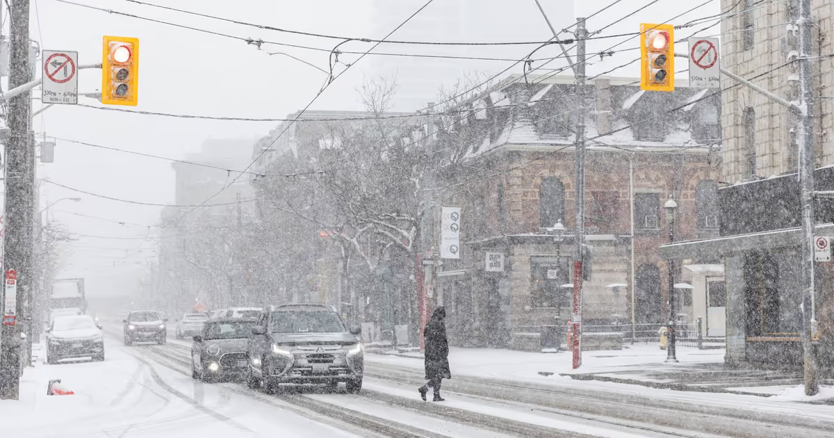
Toronto and much of southern Ontario face another round of winter weather after a historic storm left parts of the city buried under as much as 56 centimetres of snow on Jan. 25. Meteorologists say a fast-moving clipper system from the Prairies will cross the region on Tuesday, producing light to moderate snow and gusty winds.
While Toronto is forecast to see only a few centimetres this time, Ontario’s traditional snowbelt could receive another 15 to 25 centimetres over the next few days, raising concerns about drifting, low visibility and added strain on municipal clearing efforts.
What to expect this week
The Weather Network projects up to 3 centimetres for Toronto from the incoming clipper, while regions north of the city may pick up substantially more. Environment and Climate Change Canada said there is a 40 per cent chance of flurries in Toronto starting Monday night and continuing until Thursday afternoon.
Gusty winds accompanying the system could produce blowing snow and pockets of near-whiteout conditions. Wind chill values will keep conditions harsh: ECCC forecasts it will feel like -25 degrees Celsius on Tuesday morning, with Thursday likely the coldest day of the week at about -20 C as an overnight low.
Where snow will be heaviest
Toronto, which bore the brunt of the record-breaking Jan. 25 storm, is expected to be lighter hit this time. The heaviest accumulations are forecast for Ontario’s snowbelt regions, including areas north and east of the city that routinely receive lake-enhanced snowfall.
A fast-moving clipper system from the Prairies will track across southern Ontario on Tuesday, bringing light snow and gusty winds that could cause blowing snow.
The Weather Network
Practical preparation and safety
Residents should plan for limited visibility, drifting on roads and heavier snow in northern suburbs. City services may face longer clearing times after repeated events, and transit authorities can expect delays on affected routes.
- Monitor local forecasts and transit alerts before heading out.
- Keep an emergency kit in your vehicle that includes a charged phone battery pack, warm blankets, a flashlight and a small shovel.
- Avoid parking on streets during expected plow times to reduce risk of being blocked in.
- Dress in layers and protect extremities when spending extended time outdoors, and limit heavy shovelling if you have heart or respiratory conditions.
- Check on neighbours who may need help clearing walkways, and follow municipal guidance for snow removal and compost/garbage collection changes.
What the longer-term outlook shows
Short-range forecasts align with broader seasonal predictions. The Farmer’s Almanac suggested more snowy periods and frigid temperatures for late January, and Environment and Climate Change Canada’s three-month outlook indicates a continued chance of winter storms into February.
That does not guarantee significant accumulations every week, but it does mean households and municipal crews may need to remain ready for recurring winter events through the rest of the season.
Community impacts and recovery
Multiple major snowfalls over a short period strain clearing budgets and can delay garbage and recycling services. Businesses dependent on deliveries may face interruptions, and increased commuter delays are likely when roads are compacted or drifting occurs. Local shelters and warming centres can become busier during prolonged cold snaps.
Neighbourhood groups and volunteer networks commonly mobilise after heavy storms to help clear sidewalks for seniors and residents with mobility challenges. Municipal websites list available services and how to report blocked hydrants or dangerous conditions.
Final thoughts
Toronto will likely escape the heaviest totals from this clipper, but the snowbelt should prepare for another measurable event. Keep an eye on forecasts, adjust travel plans as needed and follow local guidance on snow clearing to reduce risk during the coming cold and snowy stretch.
snowwinterweatherTorontoEnvironment and Climate Change Canada