Parts of Ontario forecast to get up to 40 cm of snow this week
A multi-day winter storm will bring heavy snow, blizzard conditions and dangerous wind chills to much of southern Ontario, with 20 to 40 cm possible in snowbelt areas.
Copy link
By Torontoer Staff
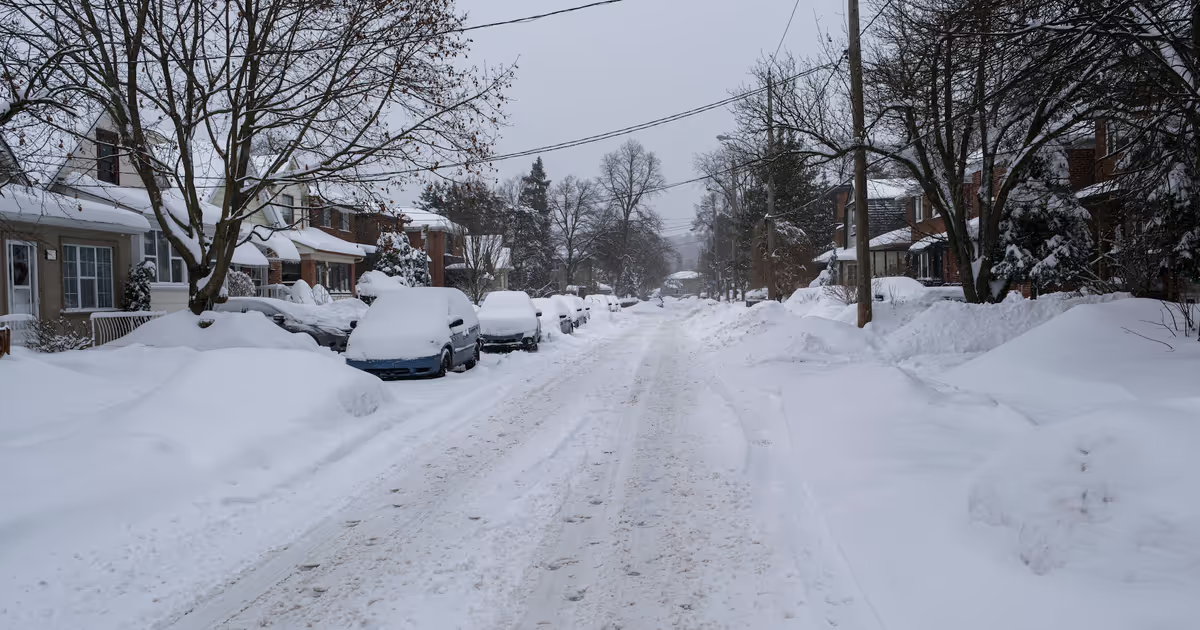
A multi-day winter storm is expected to deliver heavy snow and blizzard conditions across much of southern Ontario this week, with some snowbelt areas forecast to receive as much as 20 to 40 cm. Environment Canada has issued a mix of blizzard warnings, snow squall watches and blowing snow advisories for parts of the province.
The system follows a historic snowfall event in the Greater Toronto Area that disrupted flights, transit and schools. Forecasters say high winds, rapidly reduced visibility and additional snow will pose renewed travel and safety challenges.
Where the heaviest snow will fall
Communities along Lake Huron and Georgian Bay are among the areas at greatest risk. The Weather Network is forecasting wind gusts of 70 to 90 km/h in those regions, with total snowfall amounts of 20 to 40 cm in the most affected zones.
Prince Edward County is under a blizzard warning, with 20 to 30 cm expected by Tuesday morning. Much of southwestern Ontario is also facing blizzard conditions. Niagara Falls, Welland and Fort Erie are under snow squall warnings, where winds and bursts of heavy snow could produce 10 to 20 cm and rapid visibility drops.
- Lake Huron and Georgian Bay regions: 20 to 40 cm, gusts to 70–90 km/h
- Prince Edward County: 20 to 30 cm, blizzard warning in effect
- Niagara region: 10 to 20 cm with snow squalls and strong gusts
- Areas just north of Toronto: snow squall watches; rapid accumulation possible
Environment Canada has issued blizzard warnings, snow squall watches and blowing snow advisories across the province.
Environment Canada
Timing and likely travel impacts
The heavy snow and blowing snow will arrive in stages over several days. Blowing snow is expected to ease by Tuesday in many areas, but another low-pressure system moving in from the Prairies could bring additional snow to southern Ontario by mid-week. The Greater Toronto Area could see another 5 to 10 cm from that secondary system.
Expect reduced visibility and sudden whiteout conditions in snow squall zones, which can create dangerous driving conditions and sudden closures on highways. The previous storm led to hundreds of cancelled flights and disrupted public transit; similar disruptions are possible again. Check airline and transit advisories before travelling and allow extra time if you must be on the road.
Cold risk and the temperature outlook
Heavy precipitation will arrive with a marked Arctic chill. Some northern parts of the province could see overnight lows approach -40 degrees C, and wind chill values will be hazardous in exposed locations. Daytime highs in many areas will remain well below seasonal averages, with readings stuck in the minus teens through the weekend.
Sustained cold will keep roads icy even after the snowfall tapers, increasing the risk of black ice. Those with operations that rely on outdoor work should plan for intermittent shutdowns and additional safety measures.
Practical steps to prepare
Take common-sense precautions ahead of and during the storm to reduce risk and disruption.
- Monitor official updates from Environment Canada, The Weather Network and local authorities.
- Delay non-essential travel while warnings are in effect. If you must travel, inform someone of your route and expected arrival time.
- Keep a winter emergency kit in vehicles, including a blanket, warm clothing, water, snacks, a flashlight, a shovel and a charged phone.
- Prepare your home: ensure heating systems are working, insulate pipes, and have extra medications and supplies on hand.
- Check on vulnerable neighbours and family members, especially older adults and those with limited mobility.
- Secure outdoor items that could be blown around by strong gusts, and clear snow from vents and exhausts to prevent carbon monoxide risks.
Businesses that serve customers in affected regions should expect staffing and delivery interruptions. Public-sector operations and school boards may issue closures or modified schedules based on local conditions.
Where to get the latest information
Keep tabs on real-time sources: Environment Canada for warnings and alerts, local municipal pages for road and transit updates, and 511 Ontario for highway conditions. Airlines and major transit agencies post service notices on their websites and social channels.
Spring is roughly two months away, but for now expect an extended period of winter weather. Stay alert to changing forecasts and follow guidance from emergency services and local officials.
Ontariowinter weathersnowEnvironment Canadatravel