Sunday storm sets new snowfall records at Pearson, leaves Toronto buried
Sunday’s storm dumped record snowfall at Pearson, making this January the snowiest month on record at the airport. Lake-enhanced snow produced sharp differences across the GTA.
Copy link
By Torontoer Staff
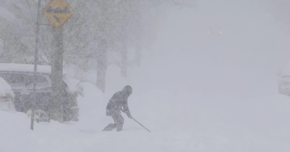
Sunday’s winter storm delivered the snowiest 24-hour total on record at Toronto Pearson Airport and pushed January totals to the highest monthly amount in the station’s history, Environment Canada data show. Pearson logged 46.2 centimetres of snow in 24 hours and 88.4 centimetres for the month.
A downtown automated sensor recorded an estimated 56 centimetres, though that measurement used a different methodology than the official Pearson count. City officials said cleanup will take several days as crews work through the piles left across neighbourhoods.
How the record was set
The previous single-day record at Pearson was 39.9 centimetres on Feb. 25, 1965. Sunday’s 46.2 centimetres surpassed that mark, and the airport’s January total of 88.4 centimetres also eclipses the city’s prior monthly highs: January 1999, which saw 79.9 centimetres, and December 1951, when 86.6 centimetres fell.
Toronto’s January 1999 event prompted Mayor Mel Lastman to call in the Canadian Forces to assist with snow clearing. By comparison, officials have so far described Sunday’s cleanup as a multi-day municipal effort.
Why Toronto was hit harder
Environment Canada pointed to lake enhancement as the main reason Toronto saw exceptional snowfall. When a storm passes over open water, it picks up added moisture that increases precipitation and strengthens the system.
There was a general snowfall from Windsor to London to Toronto to Kingston to Ottawa, but because of the east wind off Lake Ontario, parts of the Greater Toronto Area got even more moisture from this system and ended up with huge snowfall amounts, record-breaking amounts.
Geoff Coulson, Environment Canada meteorologist
Lake Ontario was roughly 75 per cent ice-free, which allowed the storm system to draw extra moisture. The effect produced sharp variations in snowfall over relatively short distances, with some neighbourhoods receiving substantially more snow than others.
Where the storm hit hardest
- Toronto Pearson Airport: 46.2 cm in 24 hours, 88.4 cm for January.
- Downtown Toronto (automated sensor): estimated 56 cm in 24 hours.
- Mississauga, Brampton, Caledon: 46.2 cm each, Environment Canada.
- Milton: about 53 cm, Weather Network estimate.
- Hamilton: official 7.6 cm, volunteer reports 10 to 20 cm; measurements were highly variable.
- London: 17 cm, Weather Network.
- Ottawa: 9 cm on Sunday, with forecasts up to 15 cm the following day.
- Kingston: forecast 15 to 25 cm.
Measurements differed between official Environment Canada stations and local or automated sensors. In exposed locations, wind and drifting complicated official counts, leading to variability across the region.
Impact and recovery
Municipal crews, transit agencies and emergency services mobilized after the storm. Some institutions closed; McMaster University, for example, cancelled in-person classes as volunteer observers reported double-digit totals in parts of Hamilton.
City officials said the cleanup will take several days. Ploughing, snow hauling and efforts to clear sidewalks and arterial roads will continue as teams prioritise safety and mobility.
Environment Canada issued local warnings and follow-up snowfall forecasts for eastern Ontario where the storm’s main band arrived later. Residents should monitor local advisories as crews work through snow removal and transportation providers adjust schedules.
Sunday’s storm reset a long-standing snowfall benchmark for the region. With record totals recorded at Pearson and uneven impacts across the Greater Toronto Area, the event will be one of the most significant winter storms in the city’s modern meteorological record.
TorontosnowweatherwinterEnvironment Canada