Toronto under snowfall warning as up to 10 cm expected Wednesday
Environment Canada has issued a yellow snowfall warning for Toronto, with up to 10 cm expected Wednesday morning. The city has begun salting and will deploy plows once thresholds are met.
Copy link
By Torontoer Staff
Environment Canada has issued a yellow snowfall warning for Toronto, forecasting up to 10 centimetres beginning Wednesday morning. The system, tracked as an Alberta clipper, will arrive during the morning commute and may cause slower travel and localized disruptions through the afternoon.
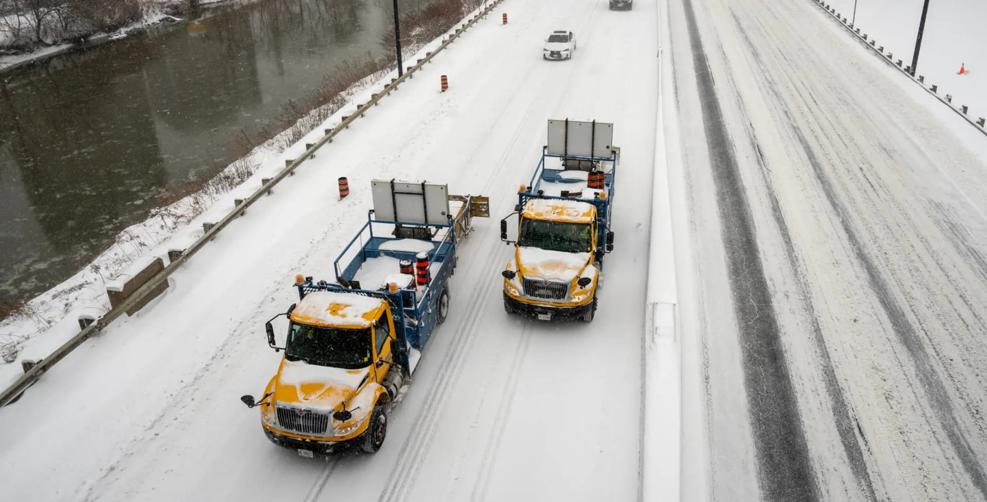
The warning arrives days after a major storm dropped more than 35 centimetres in parts of the region. City crews are still removing snow and preparing streets and sidewalks for the next round.
What to expect Wednesday
The Alberta clipper is a fast-moving, low-pressure system that typically brings quick bursts of snow and gusty winds. Environment Canada says the heaviest snowfall will coincide with the morning rush and should ease through the afternoon, though flurries could continue.
Forecast amounts are up to 10 centimetres for the city. Road conditions may be slippery, visibility reduced at times, and transit delays possible. Wind chill is already extreme and is expected to drop near minus 30 degrees Celsius by Friday, increasing the risk of frostbite for anyone outdoors for extended periods.
City response and rules
Mayor Olivia Chow and city officials say salting is underway and snow removal continues. Priority has been given to routes serving hospitals and other high-traffic corridors. Since the weekend the city reports 8,740 tonnes of snow have been picked up and removed from streets.
Salting is currently underway across the city in preparation. Since the weekend, 8,740 tonnes of snow have been picked up and removed from streets across the city. Priority was given to routes serving hospitals and high-traffic corridors.
Mayor Olivia Chow
The city will begin plowing based on established thresholds: when sidewalks and bike lanes have two centimetres of accumulation, major roads five centimetres, and residential streets eight centimetres. Temporary no-parking signs may be posted, and vehicles parked in violation could be ticketed or towed.
How this could affect your commute
Expect slower travel during the morning peak. Transit services may experience delays as streets and intersections are cleared. The system should taper off in the afternoon, but compacted or slushy surfaces can remain through the evening, especially where plows and salt have yet to reach.
- Give yourself extra travel time, particularly if driving or cycling.
- Check transit alerts before leaving, and consider allowing flexibility for delays.
- Avoid parking where temporary orange no-parking signs are posted to prevent fines or towing.
- Clear sidewalks in front of your property if snowfall stays below two centimetres, and keep well back from city crews while they work.
Cold and safety steps
Temperatures are already low and wind chills will intensify through the week. The city has activated some warming supports for vulnerable people, and residents should monitor local resources if they or someone they know needs shelter from the cold.
- Dress in layers and cover exposed skin when outside to reduce frostbite risk.
- Limit time outdoors during extreme wind chill, and check on neighbours who may be vulnerable.
- Keep phones charged and emergency kits in vehicles if travel is necessary.
How to report issues and stay updated
Service requests for snow removal can be submitted through 311 online or via the 311 app. The city posts operational updates on its website and social channels, where officials will share information about plow progress, parking restrictions and any additional supports.
Snowfall is expected on Wednesday, January 21, with the heaviest snow likely during the morning rush hour. The morning commute may be slower, so allow extra travel time and consider using public transit. Salting is underway across the city ahead of the storm.
City of Toronto
Take practical precautions and plan for delays. The storm is brief but will arrive at an inconvenient time for many, and extreme cold will remain a hazard for several days.
snowweathercity servicestransitsafety