Waterfront study outlines how a regular harbour shuttle could connect Toronto’s waterfront
A new SeaBus feasibility study lays out five route options linking Ontario Place, the Islands and the Portlands, with two routes emerging as most viable.
Copy link
By Torontoer Staff
Waterfront Toronto posted a SeaBus Feasibility Study, completed by advisory firm CPCS, that maps what a scheduled, fixed-route marine passenger service could look like in Toronto’s Inner Harbour. The study evaluates five route options to connect Ontario Place, the Toronto Islands, the Portlands and other waterfront destinations by boat.
The study focuses on whether a year-round, fixed-schedule shuttle could offer a reliable alternative to road transit and water taxis, and whether such a service could be financially and operationally viable as the waterfront grows.
What the study examined
CPCS modelled five route options running from Ontario Place in the west to Ookwemin Minising, the Toronto Islands, and the Outer Harbour in the east. Each option varies by route length, stops and operating characteristics, and the study compares ridership projections, vessel size requirements and fare levels under 2035 and 2050 demand scenarios.
The two frontrunners
After evaluating the five options, the report narrows to two routes it considers most feasible economically and logistically. Route A stays close to the mainland and is the shortest option. Route D is longer, reaching the Outer Harbour and serving more island stops.
- Route A: Ontario Place, Portland Slip, Yonge Slip, Parliament Slip, Ookwemin Minising; end-to-end travel about 24 minutes.
- Route D (option 2 highlighted in the report): same core stops as Route A plus Manitou Point, Ward’s Island — Outer Harbour, and Outer Harbour Marina; end-to-end travel about 66 minutes.
Route A would require a 24-passenger vessel in 2035 and a 50-passenger vessel by 2050 to meet projected demand. Route D would need a 75-passenger vessel by 2050, reflecting its longer alignment and higher ridership potential.
Costs, fares and ridership projections
The study estimates minimum fares needed to cover operating costs under the 2050 scenario. For Route A the minimum fare is calculated at about $11.01 per passenger, while Route D would require roughly $12 per trip. Neither option is considered economically feasible today, but the report suggests the service could potentially break even by 2035 under assumed growth and operating conditions.
Projected peak-month ridership by 2050 differs between the two options. Route D could carry approximately 153,000 passengers in its busiest month, while Route A would transport just over 121,000 passengers during its peak month.
"The service could potentially break even by 2035,"
CPCS report
How growth changes the equation
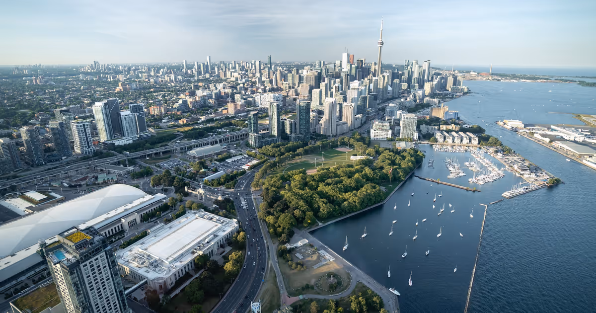
The five-kilometre stretch between Ontario Place and the Eastern Waterfront already contains over 76,000 residents and receives roughly 63 million annual trips. The report projects that by 2051 the same area will house more than 119,000 residents and see about 115 million distinct visitor trips, a scale that shifts the feasibility of fixed-route marine transit.
Because of those growth forecasts, Waterfront Toronto, Ports Toronto, and the City of Toronto have, the report says, "expressed interest" in option 2 for Route D. That specific alignment would increase service options to the Islands and reduce some operational challenges associated with navigating rougher waters in the Outer Harbour.
"expressed interest" in option 2 for Route D, which would address the immediate need to increase water taxi services to the Islands, and avoid some of the operational challenges associated with navigating a water taxi or SeaBus in the rough waters of the Outer Harbour.
CPCS report, summarising stakeholder positions
Pilot this summer
Waterfront Toronto plans a water shuttle pilot this summer to test east-west travel along the harbour. The pilot is expected to launch in June and will serve three stops: Portland Slip, the central waterfront, and Biidaasige Park. The pilot will provide short-term operational data and rider feedback to inform any longer-term SeaBus plans.
What to watch next
Key next steps include the summer pilot results, detailed cost and infrastructure planning, and stakeholder decisions on which route to prioritise. If growth follows current projections and operational challenges can be solved, a fixed-route harbour shuttle could move from concept to phased implementation over the next decade.
The study does not commit to construction or a launch date. It lays out options and trade-offs, and it makes clear that larger vessels, wharf upgrades and fare strategies will all be needed to make regular harbour transit a reliable part of the city’s waterfront travel network.
Toronto waterfrontmarine transitWaterfront TorontoSeaBustransportation