Widespread cold warnings as wind chill plunges to -50 across the Prairies
Environment Canada has issued yellow and orange cold and snow alerts from the Prairies to parts of Ontario and Quebec, with wind chill values falling as low as -50.
Copy link
By Torontoer Staff
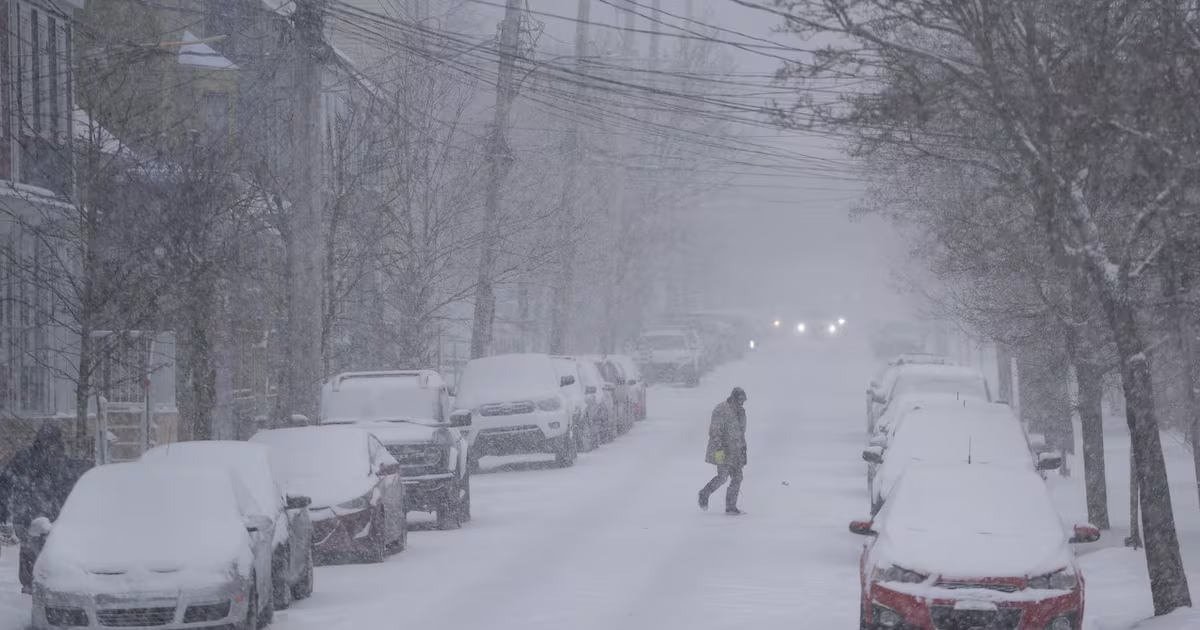
Environment Canada has issued a string of yellow and orange cold and snow alerts across much of Canada. The Prairies are hardest hit, with parts of Alberta, Saskatchewan and Manitoba facing life-threatening wind chill values this week.
Alerts also cover sections of Ontario, Quebec, the territories and Atlantic Canada, and yellow snow squall watches are in place in parts of Ontario and Quebec, including the Ottawa and Montreal regions.
Where the cold is worst
Northeast Alberta is expecting wind chill values between -40 and -50 on Thursday, part of a broader Arctic airmass pushing into the region. Most of Saskatchewan is under orange or yellow cold warnings; a central band of the province is forecast to see wind chills near -45 through Friday night. Almost all of Manitoba is under orange warnings, with wind chill values of -45 to -50 expected into the weekend.
Northwestern Ontario is also facing a multi-day episode of very cold wind chills, with values around -45 and local readings near Hudson's Bay possibly reaching -50. Environment Canada says little daytime relief is expected while the Arctic air mass remains in place.
Health risks and symptoms to watch for
Environment Canada warns that extreme cold increases the risk of serious health issues. Frostbite can occur quickly in severe wind chill, and complications can be life-threatening.
Extreme cold puts everyone at risk.
Environment Canada
The agency lists common cold-related symptoms to monitor: shortness of breath, chest pain, muscle pain or weakness, numbness, and colour changes in fingers and toes. Early signs of frostbite include tingling, numbness and a white or greyish-yellow appearance to exposed skin.
Snow squalls and travel impacts
Yellow snow squall warnings and watches are in effect for parts of northern and southwestern Ontario, Ottawa and parts of Quebec, including Montreal. Squalls can bring quick visibility reductions and sudden accumulation, creating hazardous driving conditions.
Motorists should expect rapidly changing conditions on highways and local roads. Transit services may experience delays or reduced schedules where heavy snow and strong winds combine.
Practical precautions
- Dress in layers that can be easily added or removed; include a windproof outer layer and insulated footwear.
- Limit time outdoors and avoid non-essential travel during the coldest periods.
- Monitor Environment Canada alerts and local advisories for updates and route closures.
- Carry an emergency kit in vehicles: blanket, warm clothing, water, high-energy snacks, flashlight and a charged phone.
- Check on elderly neighbours and anyone with health conditions who are more vulnerable to extreme cold.
Watch for cold-related symptoms: shortness of breath, chest pain, muscle pain and weakness, numbness and colour change in fingers and toes.
Environment Canada
Where to find updates
Environment Canada’s weather advisories map lists current warnings and areas under watch, and local meteorological services are issuing hourly updates. National and regional weather hubs provide short-term forecasts and road condition alerts.
Follow local news and official advisories before heading out, and plan activities with the cold snap in mind to reduce health and travel risks.
weatherEnvironment CanadacoldsnowPrairies